
Desert Aire Regional Airport

Still image from the agency, re-checked every minute while this page is open. The time shown is when your browser last loaded it, not when the camera took it.
About this camera
WSDOT traffic camera: Desert Aire Regional Airport.
This location
Nearby cameras
 SR 243 at MP 13.8: Road 24 SW5.8 km away · Washington State DOT
 SR 24 at MP 30.4: SR 241 Interchange17 km away · Washington State DOT
- Anderson Airport WeatherCam25 km away · FAA WeatherCams
 I-90 at MP 136.5: Vantage29 km away · Washington State DOT
 I-90 at MP 138: Vantage Br. (View East)29 km away · Washington State DOT
 I-90 at MP 138: Vantage Br. (View West)29 km away · Washington State DOT
 SR 240 at MP 8.2: Beloit Road31 km away · Washington State DOT
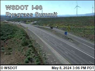 I-90 at MP 125.8: Ryegrass Summit36 km away · Washington State DOT